


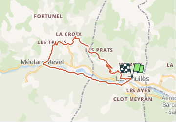
Les Thuiles/La croix/Méolans (par GR6)

andre06130
User

Length
15.6 km

Max alt
1513 m

Uphill gradient
679 m
Km-Effort
25 km

Min alt
1027 m

Downhill gradient
680 m
Boucle
Yes
Creation date :
2022-02-09 15:08:15.031
Updated on :
2022-02-10 15:59:56.052
5h36
Difficulty : Very difficult

FREE GPS app for hiking
 SityTrail
IGN / Geographical institutes
SityTrail Plus
The world is yours!
About
Trail Walking of 15.6 km to be discovered at Provence-Alpes-Côte d'Azur, Alpes-de-Haute-Provence, Les Thuiles. This trail is proposed by andre06130.
Positioning
Country:
France
Region :
Provence-Alpes-Côte d'Azur
Department/Province :
Alpes-de-Haute-Provence
Municipality :
Les Thuiles
Location:
Unknown
Start:(Dec)
Start:(UTM)
306793 ; 4918406 (32T) N.
Comments